
大籠岳 topographic map
Interactive map
Click on the map to display elevation.
About this map
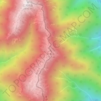
Name: 大籠岳 topographic map, elevation, terrain.
Location: 大籠岳, 静岡市, 静岡県, 420-8602, 日本 (35.59300 138.24334 35.59310 138.24344)
Average elevation: 2,438 m
Minimum elevation: 1,770 m
Maximum elevation: 2,882 m
Other topographic maps
Click on a map to view its topography, its elevation and its terrain.