
悪沢岳 topographic map
Interactive map
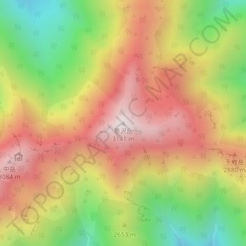
Click on the map to display elevation.
About this map
Name: 悪沢岳 topographic map, elevation, terrain.
Location: 悪沢岳, 静岡市, 静岡県, 420-8602, 日本 (35.50071 138.18237 35.50081 138.18247)
Average elevation: 2,666 m
Minimum elevation: 2,132 m
Maximum elevation: 3,137 m
三山のうち中岳と前岳は距離が300 mと近接し、最低鞍部との標高差も20から30 mほどしかない。この二山と悪沢岳は距離も1 kmほど離れ、最低鞍部との標高差も180から240 mほどあるが、三山全体と、南北に連なる赤石岳・小河内岳との間の標高差が小河内岳側で約700 m・赤石岳側で約380 mと大きいため、三山全体で一つのまとまりをなした山と見ることができる。
Other topographic maps
Click on a map to view its topography, its elevation and its terrain.