
赤石ダム topographic map
Interactive map
Click on the map to display elevation.
About this map
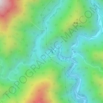
Name: 赤石ダム topographic map, elevation, terrain.
Location: 赤石ダム, 葵区, 静岡市, 静岡県, 420-8602, 日本 (35.41152 138.19842 35.41255 138.19923)
Average elevation: 1,340 m
Minimum elevation: 1,034 m
Maximum elevation: 2,074 m
Other topographic maps
Click on a map to view its topography, its elevation and its terrain.