
畑薙第二ダム topographic map
Interactive map
Click on the map to display elevation.
About this map
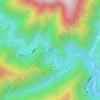
Name: 畑薙第二ダム topographic map, elevation, terrain.
Location: 畑薙第二ダム, 葵区, 静岡市, 静岡県, 420-8602, 日本 (35.30746 138.20265 35.30842 138.20376)
Average elevation: 1,045 m
Minimum elevation: 757 m
Maximum elevation: 1,619 m
Other topographic maps
Click on a map to view its topography, its elevation and its terrain.