
中岳 topographic map
Interactive map
Click on the map to display elevation.
About this map
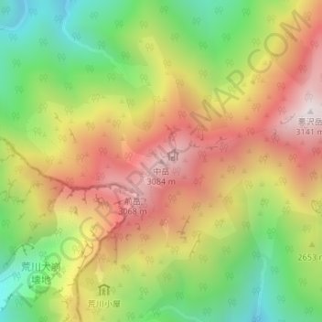
Name: 中岳 topographic map, elevation, terrain.
Location: 中岳, 静岡市, 静岡県, 中部地方, 420-8602, 日本 (35.49654 138.16699 35.49664 138.16709)
Average elevation: 2,623 m
Minimum elevation: 2,118 m
Maximum elevation: 3,137 m
Other topographic maps
Click on a map to view its topography, its elevation and its terrain.