
久能山 topographic map
Interactive map
Click on the map to display elevation.
About this map
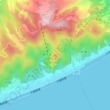
Name: 久能山 topographic map, elevation, terrain.
Location: 久能山, 静岡市, 静岡県, 420-8602, 日本 (34.96613 138.46799 34.96623 138.46809)
Average elevation: 105 m
Minimum elevation: 0 m
Maximum elevation: 295 m
Other topographic maps
Click on a map to view its topography, its elevation and its terrain.