
金精山 topographic map
Interactive map
Click on the map to display elevation.
About this map
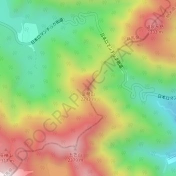
Name: 金精山 topographic map, elevation, terrain.
Location: 金精山, 日光市, 栃木県, 日本 (36.81421 139.39098 36.81431 139.39108)
Average elevation: 1,989 m
Minimum elevation: 1,626 m
Maximum elevation: 2,423 m
Other topographic maps
Click on a map to view its topography, its elevation and its terrain.