
根名草山 topographic map
Interactive map
Click on the map to display elevation.
About this map
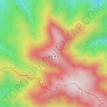
Name: 根名草山 topographic map, elevation, terrain.
Location: 根名草山, 日光市, 栃木県, 321-2717, 日本 (36.84208 139.39128 36.84218 139.39138)
Average elevation: 2,004 m
Minimum elevation: 1,613 m
Maximum elevation: 2,316 m
Other topographic maps
Click on a map to view its topography, its elevation and its terrain.