
女峰山 topographic map
Interactive map
Click on the map to display elevation.
About this map
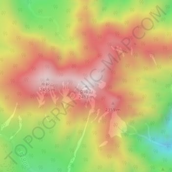
Name: 女峰山 topographic map, elevation, terrain.
Location: 女峰山, 日光市, 栃木県, 日本 (36.81139 139.53643 36.81149 139.53653)
Average elevation: 2,068 m
Minimum elevation: 1,584 m
Maximum elevation: 2,442 m
女峰山(にょほうさん)は日光市の北側、男体山の北東約7km地点にある標高2,483mの成層火山である。日光三山のひとつ。日本二百名山のひとつ。
Other topographic maps
Click on a map to view its topography, its elevation and its terrain.