
川俣ダム topographic map
Interactive map
Click on the map to display elevation.
About this map
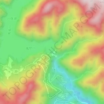
Name: 川俣ダム topographic map, elevation, terrain.
Location: 川俣ダム, 日光市, 栃木県, 日本 (36.87750 139.51992 36.87844 139.52116)
Average elevation: 1,072 m
Minimum elevation: 824 m
Maximum elevation: 1,336 m
Other topographic maps
Click on a map to view its topography, its elevation and its terrain.