
湯ノ湖 topographic map
Interactive map
Click on the map to display elevation.
About this map
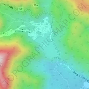
Name: 湯ノ湖 topographic map, elevation, terrain.
Location: 湯ノ湖, 日光市, 栃木県, 日本 (36.79631 139.42006 36.80482 139.42897)
Average elevation: 1,624 m
Minimum elevation: 1,394 m
Maximum elevation: 2,160 m
湯ノ湖(ゆのこ)は栃木県日光市の西部にある湖。北東にある三岳火山の噴火によってつくられた堰止湖である。標高1,478m。
Other topographic maps
Click on a map to view its topography, its elevation and its terrain.