
六甲山 topographic map
Interactive map
Click on the map to display elevation.
About this map
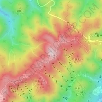
Name: 六甲山 topographic map, elevation, terrain.
Location: 六甲山, 神戸市, 兵庫県, 651-1401, 日本 (34.77794 135.26369 34.77804 135.26379)
Average elevation: 705 m
Minimum elevation: 463 m
Maximum elevation: 916 m
神戸市と西宮市の市域はこの山系によって南北に分断されているため、多数の道路、鉄道がこの山系を横断して市内を南北に連絡している。(個々の道路、鉄道は本項下部の#交通を参照)また、大阪湾に接している南西端では地形の制約から山陽電気鉄道本線、国道2号、JR山陽本線(JR神戸線)が海岸線に沿って数キロメートルにわたって併走している。そのため国道2号ではボトルネックになっており、第二神明道路がバイパス道路として整備されている。
Other topographic maps
Click on a map to view its topography, its elevation and its terrain.