
長田区 topographic map
Interactive map
Click on the map to display elevation.
About this map
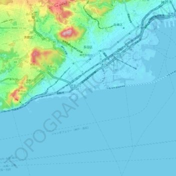
Name: 長田区 topographic map, elevation, terrain.
Location: 長田区, 神戸市, 兵庫県, 日本 (34.59946 135.12352 34.69425 135.17238)
Average elevation: 34 m
Minimum elevation: -6 m
Maximum elevation: 304 m
Other topographic maps
Click on a map to view its topography, its elevation and its terrain.