
船坂川 topographic map
Interactive map
Click on the map to display elevation.
About this map
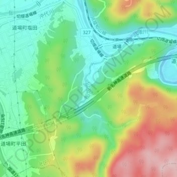
Name: 船坂川 topographic map, elevation, terrain.
Location: 船坂川, 北区, 神戸市, 兵庫県, 651-1502, 日本 (34.85484 135.24854 34.86495 135.25412)
Average elevation: 212 m
Minimum elevation: 126 m
Maximum elevation: 361 m
Other topographic maps
Click on a map to view its topography, its elevation and its terrain.