
烏原貯水池 topographic map
Interactive map
Click on the map to display elevation.
About this map
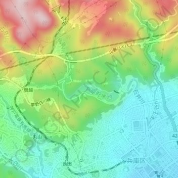
Name: 烏原貯水池 topographic map, elevation, terrain.
Location: 烏原貯水池, 兵庫区, 神戸市, 兵庫県, 652-0051, 日本 (34.69062 135.14894 34.69329 135.15910)
Average elevation: 128 m
Minimum elevation: 9 m
Maximum elevation: 330 m
Other topographic maps
Click on a map to view its topography, its elevation and its terrain.