
東ノ峰 topographic map
Interactive map
Click on the map to display elevation.
About this map
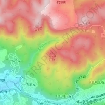
Name: 東ノ峰 topographic map, elevation, terrain.
Location: 東ノ峰, 神戸市, 兵庫県, 日本 (34.77435 135.15949 34.77445 135.15959)
Average elevation: 382 m
Minimum elevation: 177 m
Maximum elevation: 552 m
Other topographic maps
Click on a map to view its topography, its elevation and its terrain.