
垂水区 topographic map
Interactive map
Click on the map to display elevation.
About this map
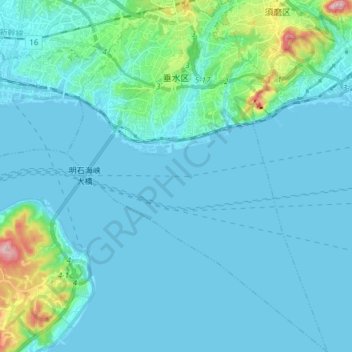
Name: 垂水区 topographic map, elevation, terrain.
Location: 垂水区, 神戸市, 兵庫県, 日本 (34.55407 135.01318 34.67830 135.12509)
Average elevation: 32 m
Minimum elevation: -3 m
Maximum elevation: 301 m
また、神戸特有の海と山が迫った地形と神戸三宮や大阪都心にも比較的近い立地から芸術家・作家・音楽家など、多くの文化人が住む。また塩屋町6丁目には「神戸ジェームス山外国人特別居住区」がある。
Other topographic maps
Click on a map to view its topography, its elevation and its terrain.