
志染川 topographic map
Interactive map
Click on the map to display elevation.
About this map
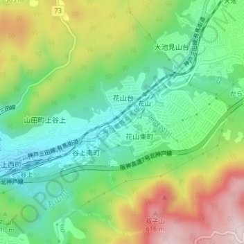
Name: 志染川 topographic map, elevation, terrain.
Location: 志染川, 神戸市, 兵庫県, 651-1332, 日本 (34.76179 135.16821 34.77133 135.19998)
Average elevation: 385 m
Minimum elevation: 232 m
Maximum elevation: 636 m
Other topographic maps
Click on a map to view its topography, its elevation and its terrain.