
立ヶ畑ダム topographic map
Interactive map
Click on the map to display elevation.
About this map
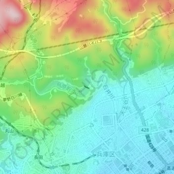
Name: 立ヶ畑ダム topographic map, elevation, terrain.
Location: 立ヶ畑ダム, 都由乃町二丁目, 兵庫区, 神戸市, 兵庫県, 652-0015, 日本 (34.69134 135.15828 34.69175 135.15933)
Average elevation: 112 m
Minimum elevation: 8 m
Maximum elevation: 330 m
Other topographic maps
Click on a map to view its topography, its elevation and its terrain.