
石井ダム topographic map
Interactive map
Click on the map to display elevation.
About this map
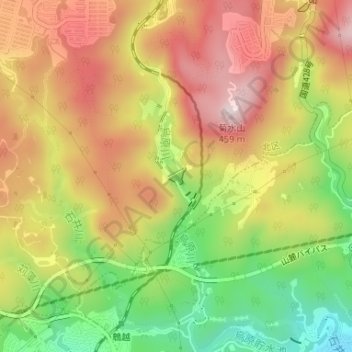
Name: 石井ダム topographic map, elevation, terrain.
Location: 石井ダム, 山田町下谷上, 北区, 神戸市, 兵庫県, 651-1101, 日本 (34.70346 135.14683 34.70484 135.14847)
Average elevation: 247 m
Minimum elevation: 25 m
Maximum elevation: 439 m
Other topographic maps
Click on a map to view its topography, its elevation and its terrain.