
日の峰北公園 topographic map
Interactive map
Click on the map to display elevation.
About this map
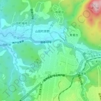
Name: 日の峰北公園 topographic map, elevation, terrain.
Location: 日の峰北公園, 日の峰四丁目, 北区, 神戸市, 兵庫県, 日本 (34.76181 135.14453 34.76241 135.14543)
Average elevation: 251 m
Minimum elevation: 168 m
Maximum elevation: 487 m
Other topographic maps
Click on a map to view its topography, its elevation and its terrain.