
寝屋川市 topographic map
Interactive map
Click on the map to display elevation.
About this map
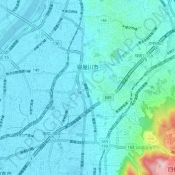
Name: 寝屋川市 topographic map, elevation, terrain.
Location: 寝屋川市, 大阪府, 日本 (34.72821 135.58701 34.79151 135.66260)
Average elevation: 37 m
Minimum elevation: -4 m
Maximum elevation: 343 m
Other topographic maps
Click on a map to view its topography, its elevation and its terrain.