
生野区 topographic map
Interactive map
Click on the map to display elevation.
About this map
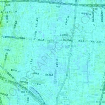
Name: 生野区 topographic map, elevation, terrain.
Location: 生野区, 大阪市, 大阪府, 日本 (34.63319 135.52439 34.66563 135.56402)
Average elevation: 8 m
Minimum elevation: 5 m
Maximum elevation: 15 m
上町台地の東側に位置し、平坦な地形が続く。区境は、西側が大阪環状線、北側が近鉄大阪線・奈良線によって形成されているために直線的なものになっている。そのために北西端に位置するJR西日本・近鉄鶴橋駅は、駅舎の一部が隣接する天王寺区や東成区にまたがる格好になっている。
Other topographic maps
Click on a map to view its topography, its elevation and its terrain.