
淀川区 topographic map
Interactive map
Click on the map to display elevation.
About this map
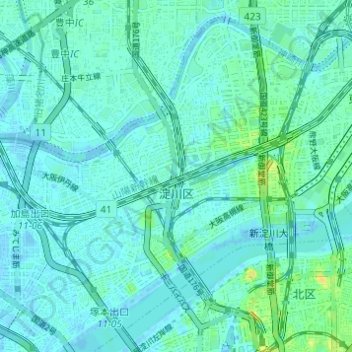
Name: 淀川区 topographic map, elevation, terrain.
Location: 淀川区, 大阪市, 大阪府, 日本 (34.70668 135.44556 34.75138 135.50671)
Average elevation: 5 m
Minimum elevation: -3 m
Maximum elevation: 22 m
Other topographic maps
Click on a map to view its topography, its elevation and its terrain.