
堺区 topographic map
Interactive map
Click on the map to display elevation.
About this map
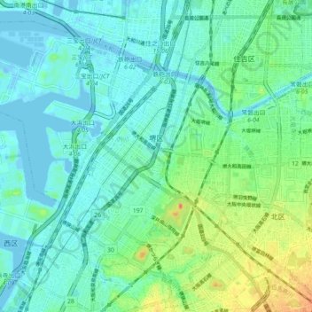
Name: 堺区 topographic map, elevation, terrain.
Location: 堺区, 堺市, 大阪府, 540-8570, 日本 (34.54565 135.38829 34.60833 135.50251)
Average elevation: 12 m
Minimum elevation: -16 m
Maximum elevation: 62 m
Other topographic maps
Click on a map to view its topography, its elevation and its terrain.