
忠岡町 topographic map
Interactive map
Click on the map to display elevation.
About this map
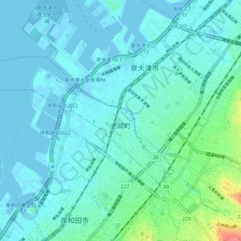
Name: 忠岡町 topographic map, elevation, terrain.
Location: 忠岡町, 泉北郡, 大阪府, 595-0801, 日本 (34.47395 135.33779 34.50951 135.41877)
Average elevation: 10 m
Minimum elevation: -4 m
Maximum elevation: 68 m