
箕面市 topographic map
Interactive map
Click on the map to display elevation.
About this map
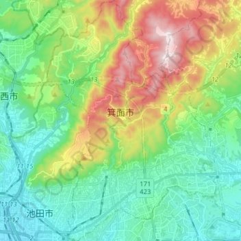
Name: 箕面市 topographic map, elevation, terrain.
Location: 箕面市, 大阪府, 日本 (34.80710 135.43700 34.91087 135.52622)
Average elevation: 216 m
Minimum elevation: 15 m
Maximum elevation: 667 m
Other topographic maps
Click on a map to view its topography, its elevation and its terrain.