
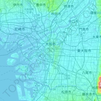
大阪市 topographic map
Interactive map
Click on the map to display elevation.
About this map
Name: 大阪市 topographic map, elevation, terrain.
Location: 大阪市, 大阪府, 日本 (34.58615 135.30998 34.76885 135.59917)
Average elevation: 10 m
Minimum elevation: -9 m
Maximum elevation: 312 m
大阪市は、淀川の河口に開けた古くからの港湾都市で、瀬戸内海と京を繋ぐ水運の要を担い、西日本の物流の中心として栄えてきた。市内の多くの場所が海抜ゼロメートル地帯であるが一部標高が20メートル以上になる地点もある。
Other topographic maps
Click on a map to view its topography, its elevation and its terrain.