
東住吉区 topographic map
Interactive map
Click on the map to display elevation.
About this map
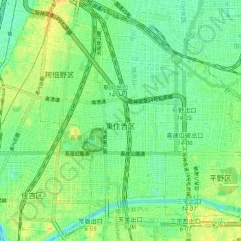
Name: 東住吉区 topographic map, elevation, terrain.
Location: 東住吉区, 大阪市, 大阪府, 日本 (34.58915 135.51399 34.64446 135.54764)
Average elevation: 11 m
Minimum elevation: 0 m
Maximum elevation: 24 m
Other topographic maps
Click on a map to view its topography, its elevation and its terrain.