
松原市 topographic map
Interactive map
Click on the map to display elevation.
About this map
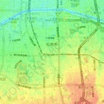
Name: 松原市 topographic map, elevation, terrain.
Location: 松原市, 大阪府, 日本 (34.55381 135.52100 34.59945 135.58576)
Average elevation: 22 m
Minimum elevation: 1 m
Maximum elevation: 45 m
Other topographic maps
Click on a map to view its topography, its elevation and its terrain.