
北区 topographic map
Interactive map
Click on the map to display elevation.
About this map
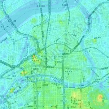
Name: 北区 topographic map, elevation, terrain.
Location: 北区, 大阪市, 大阪府, 日本 (34.68464 135.47444 34.72057 135.52295)
Average elevation: 10 m
Minimum elevation: -4 m
Maximum elevation: 51 m
Other topographic maps
Click on a map to view its topography, its elevation and its terrain.