
秋田市 topographic map
Interactive map
Click on the map to display elevation.
About this map
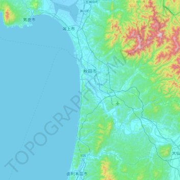
Name: 秋田市 topographic map, elevation, terrain.
Location: 秋田市, 秋田県, 日本 (39.44889 139.75704 39.86503 140.51560)
Average elevation: 107 m
Minimum elevation: -5 m
Maximum elevation: 1,139 m
Other topographic maps
Click on a map to view its topography, its elevation and its terrain.