
長岡市 topographic map
Interactive map
Click on the map to display elevation.
About this map
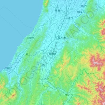
Name: 長岡市 topographic map, elevation, terrain.
Location: 長岡市, 新潟県, 中部地方, 日本 (37.17648 138.52851 37.72710 139.12428)
Average elevation: 179 m
Minimum elevation: -1 m
Maximum elevation: 1,530 m
Other topographic maps
Click on a map to view its topography, its elevation and its terrain.