
川崎市 topographic map
Interactive map
Click on the map to display elevation.
About this map
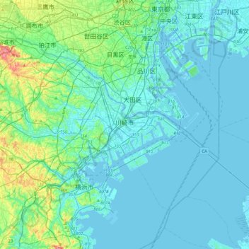
Name: 川崎市 topographic map, elevation, terrain.
Location: 川崎市, 神奈川県, 日本 (35.41141 139.44889 35.64281 139.85775)
Average elevation: 18 m
Minimum elevation: -8 m
Maximum elevation: 143 m
Other topographic maps
Click on a map to view its topography, its elevation and its terrain.