
神戸市 topographic map
Interactive map
Click on the map to display elevation.
About this map
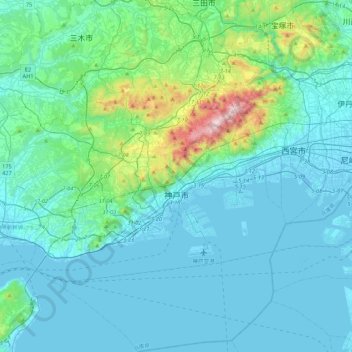
Name: 神戸市 topographic map, elevation, terrain.
Location: 神戸市, 兵庫県, 日本 (34.53241 134.91002 34.89058 135.32973)
Average elevation: 115 m
Minimum elevation: -8 m
Maximum elevation: 916 m
Other topographic maps
Click on a map to view its topography, its elevation and its terrain.