
六本木 topographic map
Interactive map
Click on the map to display elevation.
About this map
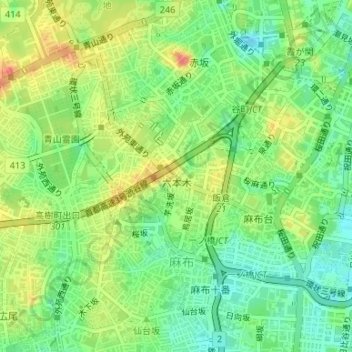
Name: 六本木 topographic map, elevation, terrain.
Location: 六本木, 港区, 東京都, 日本 (35.65709 139.72367 35.66868 139.74367)
Average elevation: 27 m
Minimum elevation: 2 m
Maximum elevation: 58 m
Other topographic maps
Click on a map to view its topography, its elevation and its terrain.