
四日市市 topographic map
Interactive map
Click on the map to display elevation.
About this map
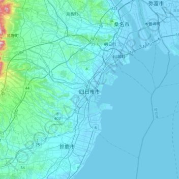
Name: 四日市市 topographic map, elevation, terrain.
Location: 四日市市, 三重県, 日本 (34.86351 136.41347 35.07051 136.74323)
Average elevation: 35 m
Minimum elevation: -7 m
Maximum elevation: 602 m
Other topographic maps
Click on a map to view its topography, its elevation and its terrain.