Click on a map to view its topography, its elevation and its terrain.
日本 > 洲本市
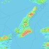
淡路島, 洲本市, 兵庫県, 日本
Average elevation: 23 m
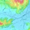
洲本川, 洲本市, 兵庫県, 日本
Average elevation: 34 m
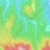
竹原貯水池, 洲本市, 兵庫県, 日本
Average elevation: 188 m