
摺鉢山 topographic map
Interactive map
Click on the map to display elevation.
About this map
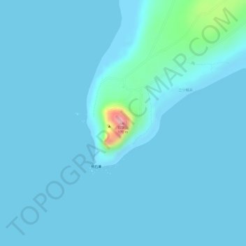
Name: 摺鉢山 topographic map, elevation, terrain.
Location: 摺鉢山, 東京都, 日本 (24.75042 141.28912 24.75052 141.28922)
Average elevation: 11 m
Minimum elevation: 0 m
Maximum elevation: 165 m
Other topographic maps
Click on a map to view its topography, its elevation and its terrain.