
西之島 topographic map
Interactive map
Click on the map to display elevation.
About this map
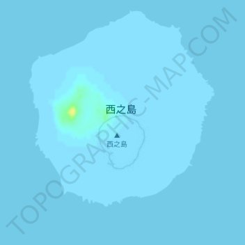
Name: 西之島 topographic map, elevation, terrain.
Location: 西之島, 小笠原支庁, 東京都, 日本 (27.23672 140.86904 27.25402 140.89024)
Average elevation: 0 m
Minimum elevation: 0 m
Maximum elevation: 20 m
2020年6月時点における面積は約4.1平方キロメートル、最高標高は約200メートルで、海底からの比高は4,000メートル程度。
Other topographic maps
Click on a map to view its topography, its elevation and its terrain.