
不動池 topographic map
Interactive map
Click on the map to display elevation.
About this map
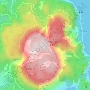
Name: 不動池 topographic map, elevation, terrain.
Location: 不動池, 天上山, 神津島村, 大島支庁, 東京都, 日本 (34.22121 139.15746 34.22142 139.15765)
Average elevation: 270 m
Minimum elevation: 0 m
Maximum elevation: 556 m
Other topographic maps
Click on a map to view its topography, its elevation and its terrain.