
酉谷山 topographic map
Interactive map
Click on the map to display elevation.
About this map
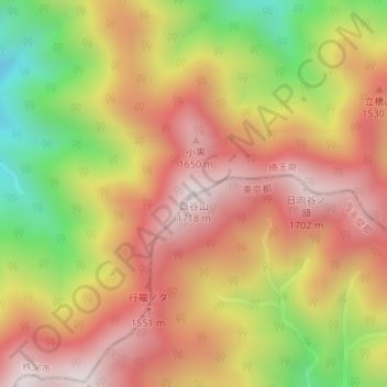
Name: 酉谷山 topographic map, elevation, terrain.
Location: 酉谷山, 東京都, 3691901, 日本 (35.89707 139.01028 35.89717 139.01038)
Average elevation: 1,345 m
Minimum elevation: 873 m
Maximum elevation: 1,689 m
Other topographic maps
Click on a map to view its topography, its elevation and its terrain.