
鷹巣山 topographic map
Interactive map
Click on the map to display elevation.
About this map
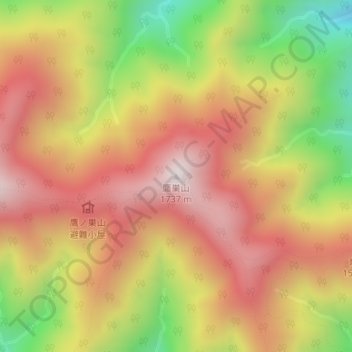
Name: 鷹巣山 topographic map, elevation, terrain.
Location: 鷹巣山, 東京都, 日本 (35.82984 139.01227 35.82994 139.01237)
Average elevation: 1,336 m
Minimum elevation: 821 m
Maximum elevation: 1,718 m
鷹ノ巣山(たかのすやま)は東京都西多摩郡奥多摩町にある標高1,736.6mの山である。石尾根の中間に位置する。
Other topographic maps
Click on a map to view its topography, its elevation and its terrain.