
武能岳 topographic map
Interactive map
Click on the map to display elevation.
About this map
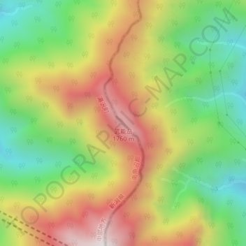
Name: 武能岳 topographic map, elevation, terrain.
Location: 武能岳, みなかみ町, 利根郡, 群馬県, 日本 (36.86702 138.91959 36.86712 138.91969)
Average elevation: 1,332 m
Minimum elevation: 917 m
Maximum elevation: 1,817 m
Other topographic maps
Click on a map to view its topography, its elevation and its terrain.