
オジカ沢ノ頭 topographic map
Interactive map
Click on the map to display elevation.
About this map
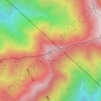
Name: オジカ沢ノ頭 topographic map, elevation, terrain.
Location: オジカ沢ノ頭, みなかみ町, 利根郡, 群馬県, 日本 (36.82922 138.91260 36.82932 138.91270)
Average elevation: 1,488 m
Minimum elevation: 907 m
Maximum elevation: 1,929 m
Other topographic maps
Click on a map to view its topography, its elevation and its terrain.