
武尊山 topographic map
Interactive map
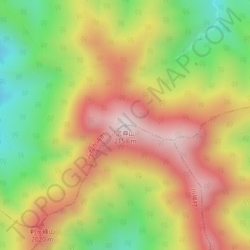
Click on the map to display elevation.
About this map
Name: 武尊山 topographic map, elevation, terrain.
Location: 武尊山, みなかみ町, 利根郡, 群馬県, 378-0101, 日本 (36.80521 139.13261 36.80531 139.13271)
Average elevation: 1,795 m
Minimum elevation: 1,434 m
Maximum elevation: 2,135 m
武尊山(ほたかやま)は、群馬県利根郡みなかみ町、川場村、片品村の境にある標高2,158mの成層火山である。北アルプスの穂高岳と区別するため、上州武尊山とも呼ばれる。日本百名山及び新・花の百名山に選定されている山である。
Other topographic maps
Click on a map to view its topography, its elevation and its terrain.