
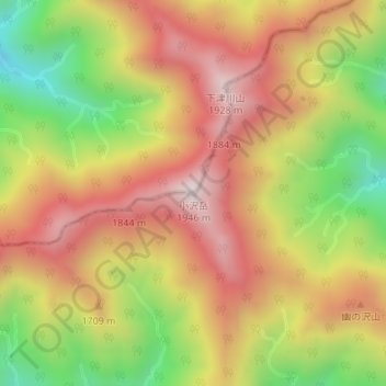
小沢岳 topographic map
Interactive map
Click on the map to display elevation.
About this map
Name: 小沢岳 topographic map, elevation, terrain.
Location: 小沢岳, みなかみ町, 利根郡, 群馬県, 日本 (36.98721 139.04718 36.98731 139.04728)
Average elevation: 1,590 m
Minimum elevation: 1,172 m
Maximum elevation: 1,930 m
Other topographic maps
Click on a map to view its topography, its elevation and its terrain.