
南沢岳 topographic map
Interactive map
Click on the map to display elevation.
About this map
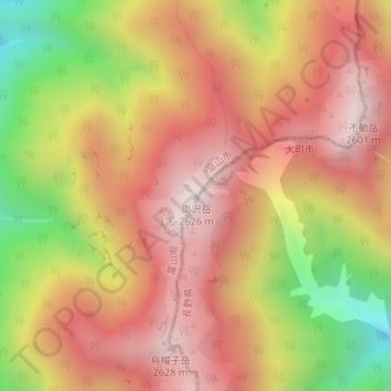
Name: 南沢岳 topographic map, elevation, terrain.
Location: 南沢岳, 富山市, 富山県, 日本 (36.48983 137.65309 36.48993 137.65319)
Average elevation: 2,197 m
Minimum elevation: 1,569 m
Maximum elevation: 2,619 m
Other topographic maps
Click on a map to view its topography, its elevation and its terrain.