
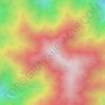
鍬崎山 topographic map
Interactive map
Click on the map to display elevation.
About this map
Name: 鍬崎山 topographic map, elevation, terrain.
Location: 鍬崎山, 富山市, 富山県, 日本 (36.53989 137.47798 36.53999 137.47808)
Average elevation: 1,619 m
Minimum elevation: 955 m
Maximum elevation: 2,064 m
Other topographic maps
Click on a map to view its topography, its elevation and its terrain.