
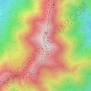
野口五郎岳 topographic map
Interactive map
Click on the map to display elevation.
About this map
Name: 野口五郎岳 topographic map, elevation, terrain.
Location: 野口五郎岳, 富山市, 富山県, 日本 (36.43266 137.63783 36.43276 137.63793)
Average elevation: 2,531 m
Minimum elevation: 2,041 m
Maximum elevation: 2,920 m
野口五郎岳(のぐちごろうだけ)は、飛騨山脈中部にある、標高2,924mの山。
Other topographic maps
Click on a map to view its topography, its elevation and its terrain.